Sunday, June 22, 2008

Week 12 - Cyprus


The country for this week is Cyprus.

Cyprus is Eurasian island located in the eastern Mediterranean, just below the Anatolian peninsula. It is the third largest island in the Mediterranean Sea.


Here is a map of Cyprus in relation to the Mediterranean Sea and other countries around it (click to enlarge):


Cyprus has long been a crossing point between Europe, Asia and Africa and still has many traces of successive civilizations – Roman theaters and villas, Byzantine churches and monasteries, Crusader castles and prehistoric habitats.

The island’s main economic activities are tourism, clothing and craft exports and merchant shipping. Traditional crafts include embroidery, pottery and copper-work.

Since Turkey occupied the north of the island in 1974, the Turkish Cypriot and Greek Cypriot communities have been separated by the so-called Green Line.


This is a map of the Green Line (click to enlarge):


http://en.wikipedia.org/wiki/Cyprus

http://news.bbc.co.uk/2/hi/europe/country_profiles/1016541.stm

https://www.cia.gov/library/publications/the-world-factbook/geos/cy.html


http://www.world-flags.info/Europe/cyprus.html


Pictures of Cyprus:

Monday, June 2, 2008

Week 11 - Croatia


This week we'll be studying Croatia.

The capital of Croatia is Zagreb.

Croatia is shaped like a crescent or a horseshoe, which flanks its neighbors Serbia, Bosnia and Herzegovina, and Montenegro. To the north lie Slovenia and Hungary. Its southern and western sides border the Adriatic Sea, and it shares a sea border with Italy in the Gulf of Trieste. Its mainland territory is split in two non-contiguous parts by the short coastline of Bosnia and Herzegovina around Neum.

The lands that today comprise Croatia were part of the Austro-Hungarian Empire until the close of World War I. In 1918, the Croats, Serbs, and Slovenes formed a kingdom known after 1929 as Yugoslavia. Following World War II, Yugoslavia became a federal independent Communist state under the strong hand of Marshal Tito. Although Croatia declared its independence from Yugoslavia in 1991, it took four years of sporadic, but often bitter, fighting before occupying Serb armies were mostly cleared from Croatian lands. Under UN supervision, the last Serb-held enclave in eastern Slavonia was returned to Croatia in 1998.

http://en.wikipedia.org/wiki/Croatia

https://www.cia.gov/library/publications/the-world-factbook/geos/hr.html

http://news.bbc.co.uk/2/hi/europe/country_profiles/1097128.stm

http://www.world-flags.info/Europe/croatia.html


Pictures of Croatia:

Saturday, May 10, 2008

Week 9 - Bosnia and Herzegovina


This week - Bosnia and Herzegovina.

The capital is Sarajevo.
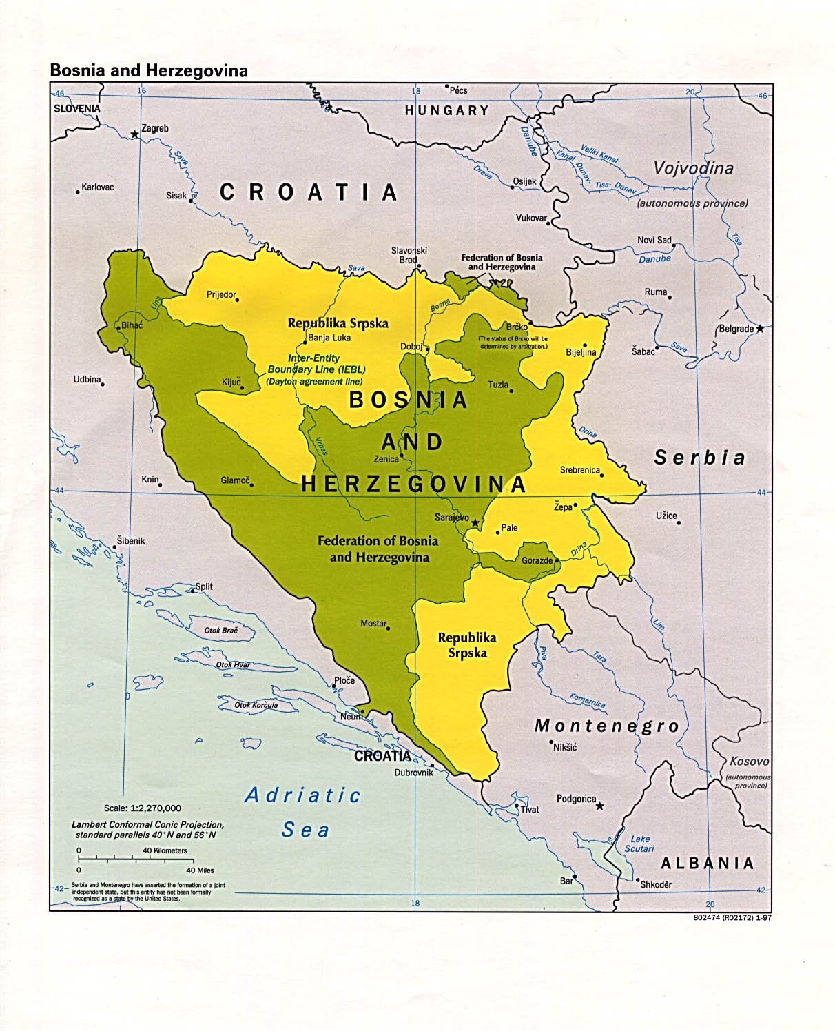


Approximate
borders
between
Bosnia (dark)
and Herzegovina (light)

(click to enlarge)


Bosnia-Herzegovina is recovering from a devastating three-year war, which accompanied the break-up of Yugoslavia in the early 1990s.

The 1992-1995 conflict centered on whether Bosnia should stay in the Yugoslav Federation, or whether it should become independent.

The country is home to three ethnic groups: Bosniaks (Muslims), Croats, and Serbs.

After the collapse of communism, a significant split developed between these groups on the issue of whether to stay with the Yugoslav federation (overwhelmingly favored among Serbs) or seek independence (overwhelmingly favored among Bosniaks and Croats).

Croat and Muslim nationalists formed a tactical alliance and outvoted the Serbs at an independence referendum. Serb nationalists were incensed as the constitution stipulated that all major decisions must be reached through consensus.

But Bosnia and Herzegovina declared independence nevertheless. Following a tense period of escalating tensions and sporadic military incidents, open warfare began in Sarajevo on April 6, 1992.

International recognition of Bosnia and Herzegovina increased diplomatic pressure for the Yugoslav People's Army (JNA) to withdraw from the republic's territory which they officially did. However, the Bosnian Serb members of JNA simply changed insignia, formed the Army of Republika Srpska, and continued fighting. Armed and equipped from JNA stockpiles in Bosnia, supported by volunteers and various paramilitary forces from Serbia, and receiving extensive humanitarian, logistical and financial support from the Federal Republic of Yugoslavia, Republika Srpska's offensives in 1992 managed to place much of the country under its control.

Map of the territory of Republika Srpska (click to enlarge):


What happened in the weeks after the Serb offensive have since been described as the worst atrocity in Europe since World War II.

Ethnic cleansing and civil rights violations against non-Serbs were rampant in the areas under Republika Srpska’s control. DNA teams are still digging through the mass graves which were left as a result of the campaign. One single most prominent example is the Massacre of Srebrenica, ruled genocide by the International Criminal Tribunal for the former Yugoslavia.

UN safe havens for Bosnian Muslim civilians were created, to include Sarajevo, Gorazde and Srebrenica.


The Bosnian Serb army under Ratko Mladic seized control of the United Nations safe haven of Srebrenica after Dutch peacekeepers were forced to withdraw. Some 1,500 Serb troops overran the lightly-armed Dutch troops, despite two Nato air strikes on Serbian tanks inside the enclave. An estimated 8,000 Bosnian Muslim men and boys were separated from their families and massacred. Up to 30,000 refugees from the mainly Muslim town were reported to be fleeing to the north.

One survivor recalled:

“When they opened fire, I threw myself on the ground. (…) And one man fell on my head. I think that he was killed on the spot. And I could feel the hot blood pouring over me. (…) I could hear one man crying for help. He was begging them to kill him. And they simply said "Let him suffer. We'll kill him later."

Another survivor said:

I was really sorry that I would die of thirst, and I was trying to hide among the people for as long as I could, like everybody else. I just wanted to live for another second or two. And when it was my turn, I jumped out with what I believe were four other people. I could feel the gravel beneath my feet. It hurt. (…) I was walking with my head bent down and I wasn't feeling anything. (…) And then I thought that I would die very fast, that I would not suffer. And I just thought that my mother would never know where I had ended up. This is what I was thinking as I was getting out of the truck. (…) I was still very thirsty. But it was sort of between life and death. I didn't know whether I wanted to live or to die anymore. I decided not to call out for them to shoot and kill me, but I was sort of praying to God that they'd come and kill me.”

The Serbs took large groups of men to warehouses and mowed them down with machine guns and explosives. Armed guards shot at the men who tried to climb out the windows to escape the massacre. When the shooting stopped, the shed was full of bodies. Another survivor, who was only slightly wounded, reports:

“I was not even able to touch the floor, the concrete floor of the building (…) After the shooting, I felt a strange kind of heat, warmth, which was actually coming from the blood that covered the concrete floor, and I was stepping on the dead people who were lying around. But there were even people who were still alive, who were only wounded, and as soon as I would step on one, I would hear him cry, moan, because I was trying to move as fast as I could. I could tell that people had been completely disembodied, and I could feel bones of the people that had been hit by those bursts of gunfire or shells, I could feel their ribs crushing. And then I would get up again and continue.”

The above quotes are from "Prosecutor vs. Krstic, First Judgement". United Nations. 2 August 2001.

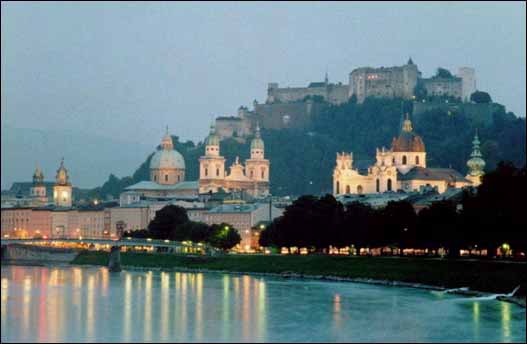
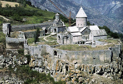
http://en.wikipedia.org/wiki/Bosnia_and_Herzegovina

http://news.bbc.co.uk/2/hi/europe/country_profiles/1066886.stm

https://www.cia.gov/library/publications/the-world-factbook/geos/bk.html


Pictures of Bosnia and Herzegovina:

Sunday, May 4, 2008

Week 8 - Belgium


The country for this week is Belgium.

The capital of Belgium is Brussels.

For such a small country, Belgium has been a major European battleground over the centuries.

Occupied by Germany during World Wars I and II, it has experienced an economic boom in the last 50 years to become a model Western European liberal democracy.

However, there has also been a growing divide between the mainly Dutch-speaking north and the mainly French-speaking south, with some even speculating that the country could break up.

Map of the regions in which different languages are spoken (click to enlarge):


http://en.wikipedia.org/wiki/Belgium

https://www.cia.gov/library/publications/the-world-factbook/geos/be.html

http://news.bbc.co.uk/2/hi/europe/country_profiles/999709.stm


Pictures of Belgium:

Sunday, April 27, 2008

Week 7 - Belarus


This week we are studying Belarus, a landlocked country in Eastern Europe. It borders Russia, Ukraine, Poland, Latvia, and Lithuania.

Belarus is relatively flat and contains large tracts of marshy land. About 34% of Belarus is covered by forests.

Many streams and 11,000 lakes are found in Belarus. Three major rivers run through the country: the Neman, the Pripyat, and the Dnepr.

The capital of Belarus is Minsk.

http://en.wikipedia.org/wiki/Belarus

https://www.cia.gov/library/publications/the-world-factbook/geos/bo.html

http://news.bbc.co.uk/2/hi/europe/country_profiles/1102180.stm


http://world-flags.info/Europe/belarus.html


Pictures of Belarus:

Sunday, April 20, 2008

Week 6 - Azerbaijan


Azerbaijan is the country for this week.

The capital of Azerbaijan is Baku.

Azerbaijan is a secular and unitary republic.

93%-96% of the population is Muslim, 85% of these Shia, 15% Sunni.

After the Russian Empire collapsed in World War 1, Armenia, Georgia, and Azerbaijan joined together to become the Transcaucasian Democratic Federative Republic. It was short-lived however, and dissolved in 1918.
Azerbaijan declared independence as the Azerbaijan Democratic Republic (ADR), but it only lasted 23 months because of the Bolshevic XIth Red Army invasion in April 1920. The ADR was overthrown and the Bolshevics established the Azerbaijan SSR. Another union with Armenia and Georgia was formed, making up the Transcaucasian Soviet Federative Socialist Republic (TSFSR).
In 1936 the TSFSR was dissolved and Azerbaijan SSR became one of the 12 constituent member states of the Soviet Union.
During the 1940's, Azerbaijan played an important part in supplying much of the Soviet Union's oil on the Eastern Front of World War II, and close to 600,000 Azerbaijanis fought on this front against Nazi Germany. Adolf Hitler launched Operation Edelweiss with the intent of capturing the Caucasian oil fields and Baku, but all the offenses were pushed back and the efforts made by the Germans were fruitless.
Civil unrest grew in parts of the Soviet Union including Nagorno-Karabakh, a region of the Azerbaijan SSR. These disturbances resulted in calls for independence and secession from the USSR.
In 1990, the Supreme Council of the Azerbaijan SSR dropped the words "Soviet Socialist" from the title, adopted the Declaration of Sovereignty of the Azerbaijan Republic, and restored the modified flag of the ADR.
In 1991, the Supreme Council of Azerbaijan established the office of the presidency, and Ayaz Mutallibov was elected as president (he was the only candidate).
On October 18, 1991, the Supreme Council of Azerbaijan adopted a Declaration of Independence which was affirmed nationwide in December when the Soviet Union was officially dissolved.
The early years of independence, however, were overshadowed by the Nagoro-Karabakh War with neighboring Armenia.
By the end of hostilities in 1994, Azerbaijan lost control of up to 16% of its internationally recognized territory, including Nagoro-Karabakh itself.
The territorial ownership of Nagorno-Karabakh today is still a heavily disputed issue between Armenia and Azerbaijan.

http://en.wikipedia.org/wiki/Azerbaijan

http://news.bbc.co.uk/2/hi/europe/country_profiles/1235976.stm

https://www.cia.gov/library/publications/the-world-factbook/geos/aj.html

I also found this cool new site:

http://www.world-flags.info/Europe/europe.html


Pictures of Azerbaijan:

Sunday, April 6, 2008

Week 4 - Armenia


This week we'll be looking at Armenia, which is a transcontinental country at the juncture of Eastern Europe and Western Asia.

The capital of Armenia is Yerevan.

http://en.wikipedia.org/wiki/Armenia

http://news.bbc.co.uk/2/hi/europe/country_profiles/1108052.stm

https://www.cia.gov/library/publications/the-world-factbook/geos/am.html


Pictures of Armenia:

Week 3 - Andorra


This week we'll be studying Andorra, a tiny country nestled in between Spain and France.

The capital of Andorra is Andorra la Vella.

Here are some sites about Andorra:

http://en.wikipedia.org/wiki/Andorra

https://www.cia.gov/library/publications/the-world-factbook/geos/an.html

http://news.bbc.co.uk/2/hi/europe/country_profiles/992562.stm


Pictures of Andorra:

Week 2 - Albania


I thought this week we could study Albania (coordinates 41° 20′ 0″ N, 19° 48′ 0″ E.)

Albania's capital is Tirana.

Here are some sites on Albania:

http://en.wikipedia.org/wiki/Albania

https://www.cia.gov/library/publications/the-world-factbook/geos/al.html

http://news.bbc.co.uk/2/hi/europe/country_profiles/1004234.stm


Pictures of Albania:

Week 1 - Europe


This week I thought that it would be good to study Europe as a whole so we can get the big picture before we dive into the smaller countries.

Here is the link for an overview of Europe:

http://en.wikipedia.org/wiki/Europe